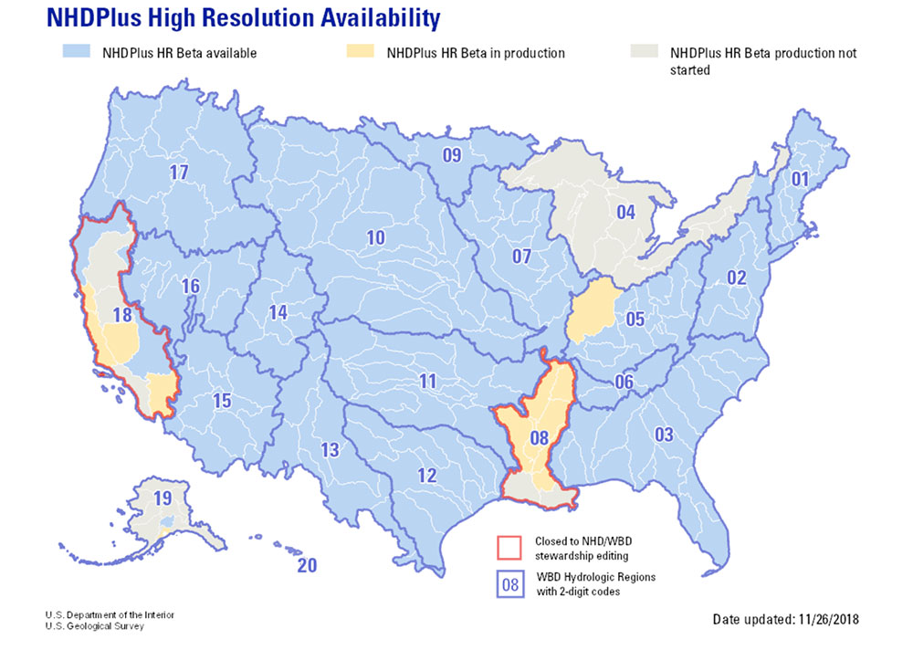
National Hydrography Dataset and Watershed Boundary Dataset
The National Hydrography Dataset (NHD) and Watershed Boundary Dataset (WBD) are digital geospatial datasets that map the surface water of the United States.
The NHD represents the national drainage networks and related surface water features including rivers, streams, canals, lakes, ponds, glaciers, coastlines, dams, and stream gauges. The NHD has attributed these features and includes classification and other characteristics, delineation, geographic name, position and related measures, a "reach code" through which other information can be related to the NHD including the direction of water flow. This network of reach codes allows analysis for tracing movement in upstream and downstream directions. The NHD can support many applications, such as making maps, geocoding observations, flow modeling, data maintenance, and stewardship.
The WBD represents drainage areas of the country in eight nested levels called hydrologic unit codes(HUCs).
Texas stretches across three HUC-2 regions encompassing the Arkansas-White-Red Region, Texas-Gulf Region and Rio Grande Region; furthermore, Texas contains over 6,450 HUC-12 Subwatershed. The NHD for Texas contains over 1.5 Million features.