FAQ - Frequently Asked Questions
What is a geographic land parcel?
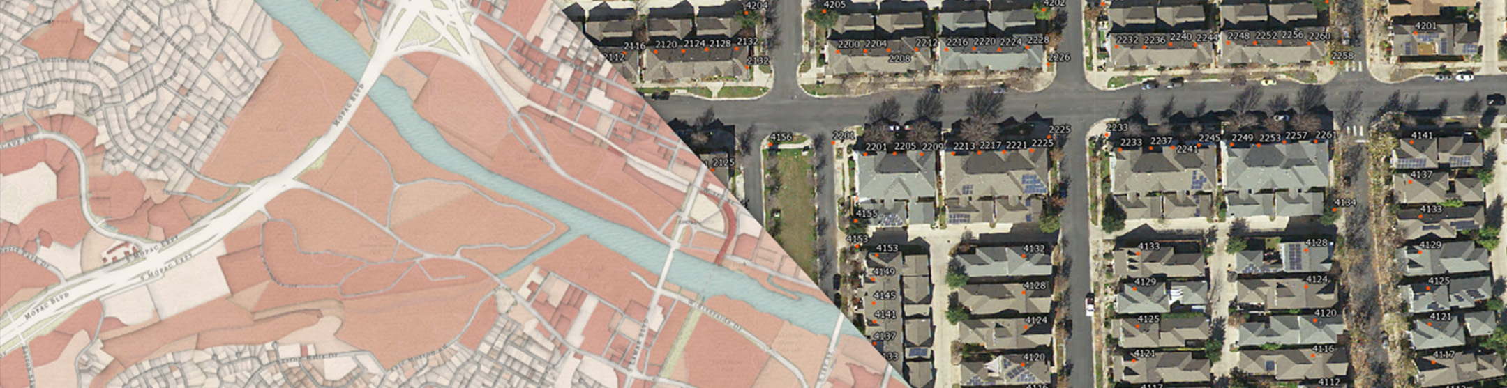
A geographic land parcel is a spatial reference to tabular information of a property regarding ownership, land use, legal description, ownership, etc. from the Computer Assisted Mass Appraisal (CAMA) software of an appraisal district.
What format and files are provided?
The land parcels are in shapefile and geodatabase format and require a geographic information system (GIS) software for viewing. Software to view this data is not provided by TxGIO. Other files provided include metadata and conversion file.
What schema are the data provided?
The data were transformed into the TxGIO land parcel schema. TxGIO facilitated a land parcel committee to discuss the data needs of stakeholders across Texas. Land parcels have a large quantity of data stored in Computer Assisted Mass Appraisal (CAMA) and a lowest common denominator of details were agreed upon for the TxGIO land parcel schema.
Why are some of the attributes missing or null?
TxGIO received the data from the appraisal districts or their vendors “as-is.” If data are missing, the data were not shared with the request for information. Over time, we hope to get as many of the TxGIO land parcel schema attributes as possible. If additional information is needed, please contact the appraisal district. A directory of appraisal districts is located on the Texas Comptroller of Public Accounts website.
Who created these geographic land parcels?
These geographic land parcel data are created by county appraisal districts or their third party vendor. TxGIO compiles and transforms these data for statewide distribution and does not edit the geometry of this data. A directory of appraisal districts is located on the Texas Comptroller of Public Accounts website.
What is the purpose of these geographic land parcels?
TxGIO collects these data to allow end users to acquire statewide land parcel data in one location at no cost. These geographic land parcel data are created by appraisal districts or their third party vendor to supplement the appraisal process with a visual representation of property. They are not survey grade and should not be used for legal purposes.
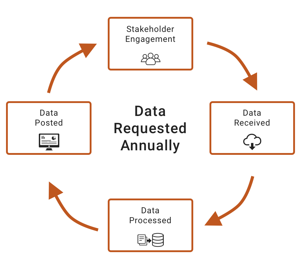
How frequently does TxGIO acquire geographic land parcel data?
TxGIO will attempt to refresh annually from each appraisal district or their third party vendor. The refresh rate will vary across the state. Some counties may refresh multiple times within one year. The year and month of the land parcel dataset is included in the file name as YYYYMM.
Is this data available at other locations?
The purpose of this initiative is to provide statewide land parcel data in one location at no cost. Yes, this data may sometimes be acquired through appraisal districts, their 3rd party vendor, or commercial vendors. More current data and greater volume of information may be available from them as compared to the no cost TxGIO statewide version. A directory of appraisal districts is located on the Texas Comptroller of Public Accounts website.
How many appraisal districts exist in Texas?
There are 254 counties and 253 appraisal districts in Texas (Potter and Randall counties have a joint office).
Why does each land parcel file have different attributes, codes, and definitions?
There is no state mandate for a standardized land parcel schema in Texas. Therefore, the individual appraisal district attributes are dictated by their business needs or based on their third party standards.
How do I report a “problem” with the land parcel data?
These geographic land parcel data are created by county appraisal districts or their third party vendor. TxGIO compiles these data for statewide distribution and does not edit the geometry of this data. A directory of appraisal districts is located on the Texas Comptroller of Public Accounts website.
What if the county land parcel dataset that I need is not available for download?
Not all counties are available for download from TxGIO. We continue to work with appraisal districts to provide as many county land parcel datasets as possible. As they are available, they will be posted online for download and the availability map updated. A directory of appraisal districts is located on the Texas Comptroller of Public Accounts website.
Contact TxGIO with any further questions regarding this program and someone from StratMap will get in touch with you.
Contact Us