Txgio

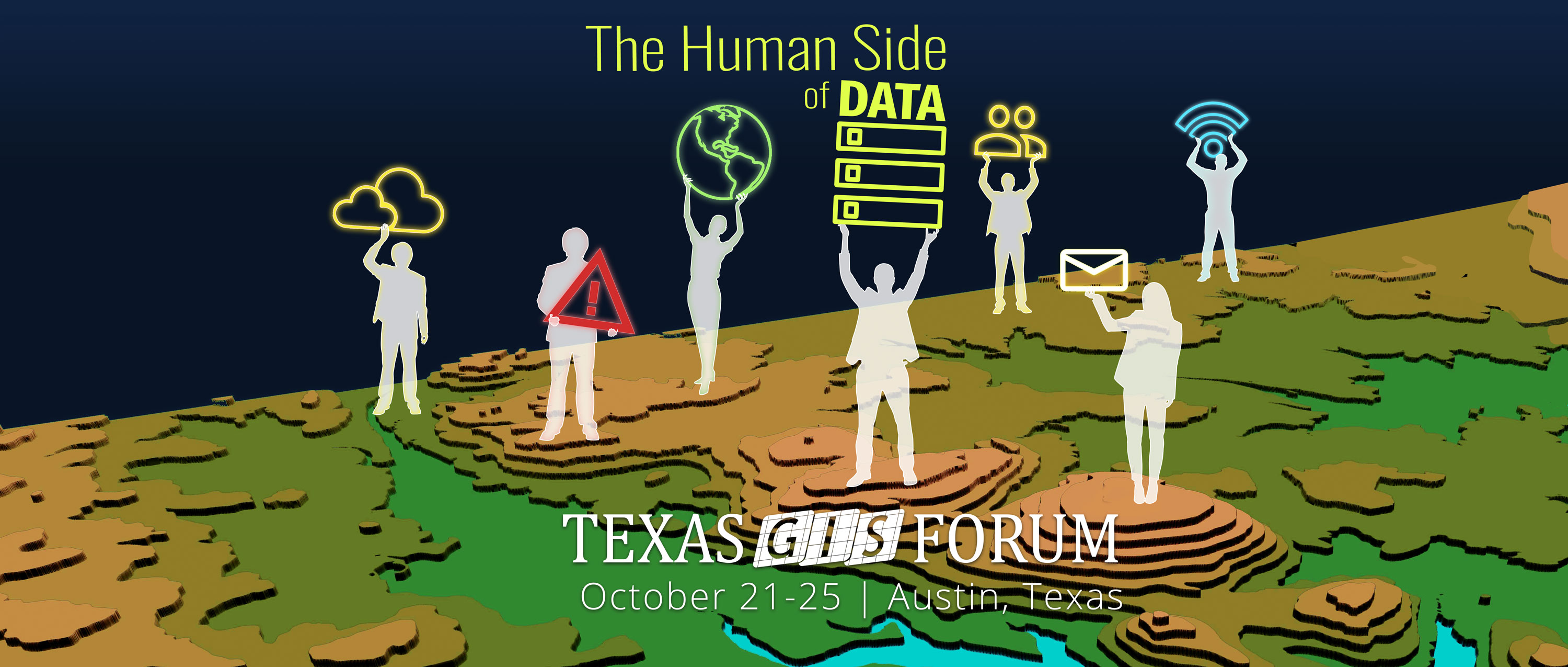
Day 1 - Monday, October 21

8:00 AM - 12:00 PM

(Almost) Everything About Census Data and Geography

James Castagneri, U.S. Census Bureau; Lacey Loftin, U.S. Census Bureau

Location: J.J. Pickle Research Center


Overview:

This workshop will cover everything you need to know to about Census data and geography. The U.S. Census Bureau is the official steward of political and statistical geographies for the U.S. Government and we will cover in detail the ways we update, maintain and use these geographies for data collection and publication. We will also cover the data that is available from the surveys and census we conduct, how to access and use that data, and interesting applications for spatial analysis.

Learning Objectives:


About the Speaker:

James Castagneri, U.S. Census Bureau

Jim Castagneri is a Geographer with the U.S. Census Bureau who manages geographic programs for Texas and the Rocky Mountain west. Early in his career, Jim was involved in the creation of the TIGER system. More recently, Jim has played a pivotal role in bringing GIS analysis to survey management and Census field operations. He specializes in Census statistical geography and the spatial analysis of demographic data.

Lacey Loftin, U.S. Census Bureau

Lacey Loftin is a statistician with the United States Census Bureau. In the 14 years that she has been with the agency, she has served as an Analyst for the Economic Census, supervised data collection operations, acted as a congressional liaison during the 2010 Census, and worked to create the Statistics in Schools program. Lacey's time is now focused on outreach to organizations and governments in Texas, sharing data, tools and useful applications.


8:00 AM - 12:00 PM

Earth Observation with Satellite Remote Sensing and ArcGIS Pro

Teresa Howard

Location: TCEQ


Overview:

Have you ever wanted to time travel? Learn how to generate your own time series using freely available satellite images from nearly anywhere on the planet. Students will learn about satellite image resources at USGS, NASA and the European Space Agency. Through hands on exercises, they will learn how to import, manipulate and analyze multispectral optical satellite data such as Landsat, Sentinel 2, MODIS, AWiFS, and other related data. Among the techniques covered are color balancing, vegetation, water and burn indices, and basic image classification. Students will take away sample datasets, step-by-step exercises and ready-to-use ModelBuilder and Python 3 script tools. This class includes hands-on practice in ArcGIS Pro. Prerequisites: basic experience in GIS software. Previous experience in ArcGIS Pro is not required.

Learning Objectives:

Have you ever wanted to time travel?

About the Speaker:

Teresa Howard

Teresa Howard is a Research Associate at the University of Texas at Austin Center for Space Research. For nearly two decades, she conducted applied research that incorporates geospatial techniques (GIS, satellite and airborne remote sensing, GPS, and digital cartography) for emergency response, land and water resources monitoring, and land cover change detection. Currently, her focus is the introduction of remote sensing technologies to high school and university students through internships and guided research. Ms. Howard formerly served as adjunct professor in the department of Geographic Information Systems at Austin Community College, where she taught classes on Esri's ModelBuilder and Python scripting for GIS. Ms. Howard holds a Master of Applied Geography degree from Texas State University-San Marcos.


8:00 AM - 12:00 PM

Insights for ArcGIS Local (Desktop)

Brig Bowles, ESRI

Location: J.J. Pickle Research Center


Overview:

Part of the Esri Geospatial Cloud, Insights for ArcGIS is analysis software that fuses location analytics with open data science and business intelligence workflows. Answer questions you didn’t know to ask, analyze data completely, and unlock new insights. A hands-on workshop to explore data and perform advanced analytics such as spatial, statistical, predictive, and link analysis within an intuitive experience that works the way you do. Revolutionize decision-making with analysis that visually informs the organization of new, previously unexplored insights gained from the perspective of “where”.

Learning Objectives:

Come learn how to create interactive reports that use text, links, images, and branding to clearly communicate your research results and show how you reached them.

About the Speaker:

Brig Bowles, ESRI

Joseph Brigham Bowles is a Solutions Engineer and works out of the Esri San Antonio office. He has been with Esri for twenty plus years focusing mainly on the technical side of the sales process. His experience is in helping companies and individuals get their data into a spatial format to better find answers to questions. His areas of expertise include web mapping, server based GIS, developer technologies, and making spatial technology available to everyone.


1:00 PM - 5:00 PM

The National Map (TNM) and National Hydrography Dataset (NHD)

Claire DeVaughan, USGS

Location: J.J. Pickle Research Center


Overview:

As one of the cornerstones of the U.S. Geological Survey's National Geospatial Program, The National Map is a collaborative effort among the USGS and other Federal, State, and local partners to improve and deliver topographic information for the Nation. It has many uses ranging from recreation to scientific analysis to emergency response. The geographic information available from The National Map includes elevation data, hydrography, land cover, geographic names, aerial photography, boundaries, transportation, and structures. This workshop will provide introductory information to The National Map and the variety of products and services it provides. Students will work with a variety of web-based applications to become familiar with the eight layers of The National Map, and learn about products, services, and data access. The latter part of the session will provide more specific information on features of the National Hydrography Dataset (NHD), the hydrography layer of The National Map, which serves as an authoritative geospatial dataset that maps and models the surface water of the United States.

Learning Objectives:

Want access to free foundational geospatial data that represents the topography, natural landscape, and manmade environment of the US? The National Map provides this and more that you can use for decision making and operational activities

About the Speaker:

Claire DeVaughan, USGS

Claire DeVaughan is the National Map Liaison for Texas, Oklahoma, and Utah. She collaborates with partners and users of The National Map to improve the timeliness, quality and accessibility of geospatial data for the user community. She has been involved in geospatial activities in Texas since 2003, Oklahoma since 2015, and Utah since February 2019. She has been with USGS since 1989, in various roles as a geographer and cartographer.


1:00 PM - 5:00 PM

The Power of a Story: Presenting Your Work Using Esri Story Maps

Kathleen Clancy, ESRI

Location: J.J. Pickle Research Center


Overview:

Stories communicate, engage, and excite while sharing information with your audience. Esri Story Maps can help you tell your story and enhance your GIS data. Esri Story Maps let you combine authoritative maps with narrative text, images, and multimedia content. They make it easy to harness the power of maps and geography to tell your story. In this hands-on workshop come learn how to author an effective story map and how to use story maps in your organization.

Learning Objectives:

Would you like to learn how to tell your story, present your data, and engage your audience?

About the Speaker:

Kathleen Clancy, ESRI

Kathleen Clancy is a Solution Engineer in the San Antonio Regional Office. While new to Esri, Kathleen has been working with Esri’s technology for over a decade. Kathleen’s previous experience includes serving as a GIS and Natural Resource Management Volunteer with the Peace Corps in Mexico’s National Park Service and working as a GIS Specialist and Research Associate for Disney’s Animals, Science, and Environment Team. Kathleen enjoys helping users find new and creative ways to meet their needs through the use of technology.


1:00 PM - 5:00 PM

Using R to Visualize US Census Data

Eric Pimpler, Geospatial Training Services

Location: TCEQ


Overview:

In this class you will learn how to use R with the tidycensus and tidyverse packages to explore and visualize US Census data. tidycensus is an R package that allows users to interface with the US Census Bureau’s decennial Census and five-year American Community APIs and return tidyverse-ready data frames, optionally with simple feature geometry included that allows you to create thematic maps. Prerequisites: Some basic R experience would be very helpful since we won't have time to cover the basics of the language itself. We'll focus specifically on using existing R skills to visualize US Census Data.

Learning Objectives:

If your work involves the use of data from the US Census Bureau and would like to use R to explore, manipulate, and visualize these datasets, the tidycensus and tidyverse packages are great tools for accomplishing these tasks.

About the Speaker:

Eric Pimpler, Geospatial Training Services

Eric is the founder and owner of GeoSpatial Training Services (geospatialtraining.com) and has over 25 years experience as an application developer, data scientist, and trainer using ArcGIS Desktop, ArcGIS Enterprise, ArcGIS Online, and ArcGIS Pro. Eric is currently focused on data science applications with Python, R, and GIS. Eric is the author of Data Visualization and Exploration with R, Programming ArcGIS with Python Cookbook, Building Web and Mobile ArcGIS Server Applications with JavaScript, Spatial Analytics with ArcGIS, ArcGIS Blueprints, and Programming ArcGIS Pro with Python. Eric has a Bachelor’s degree in Geography from Texas A&M University and a Master's of Applied Geography degree with a concentration in GIS from Texas State University.


Day 2 - Tuesday, October 22

8:00 AM - 12:00 PM

Earth Observation with Satellite Remote Sensing and QGIS

Teresa Howard

Location: TCEQ


Overview:

Are you curious about the open source geospatial world? Do you want to watch how the Earth’s surfaces changes over time and space? Come test drive QGIS and learn how to put freely available satellite images to work for you. Students will learn about satellite image resources at USGS, NASA and the European Space Agency. Students will learn about freely available satellite image resources at USGS, NASA and the European Space Agency. Through hands on exercises, they will learn how to import, manipulate and analyze multispectral optical satellite data such as Landsat, Sentinel 2, MODIS, AWiFS, and other related data. Among the techniques covered are color balancing, vegetation, water and burn indices, and basic image classification. Students will take away sample datasets, step-by-step exercises and ready-to-use Python script tools. This class includes an introduction to and hands-on practice in the open source QGIS software. Prerequisites: basic experience in GIS software. Previous experience in QGIS is not required. The Windows installation will be covered.

Learning Objectives:

Are you curious about the open source geospatial world? Do you want to watch how the Earth’s surfaces changes over time and space? Come test drive QGIS and learn how to put freely available satellite images to work for you.

About the Speaker:

Teresa Howard

Teresa Howard is a Research Associate at the University of Texas at Austin Center for Space Research. For nearly two decades, she conducted applied research that incorporates geospatial techniques (GIS, satellite and airborne remote sensing, GPS, and digital cartography) for emergency response, land and water resources monitoring, and land cover change detection. Currently, her focus is the introduction of remote sensing technologies to high school and university students through internships and guided research. Ms. Howard formerly served as adjunct professor in the department of Geographic Information Systems at Austin Community College, where she taught classes on Esri's ModelBuilder and Python scripting for GIS. Ms. Howard holds a Master of Applied Geography degree from Texas State University-San Marcos.


8:00 AM - 12:00 PM

GISP Update

Brian King, Freese & Nichols; Bill Hodge, GISCI

Location: J.J. Pickle Research Center


Overview:

This workshop session will explore the GISP Professional Certification in depth. The participany will come away with an understanding of what it is, how it might or might not help them in their career. point them in the direction of filling out the Portfolio and exploring the content of the exam and how to prepare for it.

Learning Objectives:

Is the GISP right for you?'

About the Speaker:

Brian King, Freese & Nichols

Brian King, GIS Mapping Specialist and Archeologist with Freese & Nichols’ (FNI) Austin, TX office. His responsiblities include drafting and design tasks in the areas of floodplain modeling and mapping, hydrology and hydraulics, Drone / UAS Mapping, water resources studies, ArcGIS web mapping, ArcGIS Data Collection apps, photogrammetry, remote sensing, and Lidar processing. With 19 years working in the engineering, environmental, and archeology fields, he has a passion for the industry, specifically geospatial solutions. He is an assistant instructor at the Pennsylvania State University John A. Dutton e-Education Institute, College of Earth and Mineral Sciences. Through his involvement with URISA Texas for many years, he has received recognition as a leader in the field of GIS and has served in numerous State and National elected and appointed positions.

Bill Hodge, GISCI

Bill is the Executive Director of GISCI and their geospatial Paladin since 2013, responsible for all things GISP. A GISP since 2010, he came into the GIS profession in the early 2000s with a Penn State MGIS Certiticate, and extensive Govt. GIS experience from the Federal to the Municipal level.


8:00 AM - 12:00 PM

Using ArcGIS and Open Source

Brig Bowles, ESRI

Location: J.J. Pickle Research Center


Overview:

This is a hands-on workshop to get experience using Jupyter Notebooks for simple data workflows to setting-up an enterprise system for your organization. A hands-on approach to working with a combination of opensource software and the Esri platform to get your job.

Learning Objectives:

Would you like to learn how to customize and share your projects with open-source software?

About the Speaker:

Brig Bowles, ESRI

Joseph Brigham Bowles is a Solutions Engineer and works out of the Esri San Antonio office. He has been with Esri for twenty plus years focusing mainly on the technical side of the sales process. His experience is in helping companies and individuals get their data into a spatial format to better find answers to questions. His areas of expertise include web mapping, server based GIS, developer technologies, and making spatial technology available to everyone.


1:00 PM - 5:00 PM

3-D Mapping with Point Cloud

Sean Moran, Austin Community College

Location: TCEQ Computer Training Lab


Overview:

Growth in Lidar, ortho mapping, and laser scanning is making elevation point clouds more accessible to GIS professionals. This course will demonstrate a general workflow for extracting 3D surfaces and features using industry standard and open source software. Students will: 1. Learn about remote sensing technology and 3D point clouds. 2. Georeference, merge, clip, and resample points clouds using CloudCompare 3D point cloud and mesh processing software. 3. Symbolize, classify, and process point clouds using ArcGIS Pro GIS software. 4. Extract 3D surfaces and features from point clouds. 5. Publish an interactive 3D map. Students will get hands-on experience using CloudCompare 3D and ArcGIS Pro to process 3D point clouds and create 3D maps.

Learning Objectives:

Capture, process, and map a 3D point cloud!

About the Speaker:

Sean Moran, Austin Community College

Mr. Moran is an ACC GIS Professor and former ACC GIS Department Chair. He also coordinates ACC Inc - a GIS professional incubator that facilitates internships for ACC GIS students. He has over 20 years of professional planning, Geographic Information Systems (GIS), and Global Positioning Systems (GPS) experience. He has extensive experience utilizing information technology to facilitate planning, engineering, and environmental projects. Prior to coming to Austin Community College (ACC) in 2009, Mr. Moran taught applied GIS to graduate-level planning students in the School of Architecture at the University of Texas. He has a BS in Urban Forestry from Texas A&M University and an MS in Urban Planning from the University of Texas.


1:00 PM - 5:00 PM

Exploring Spatial Data Science Analysis and Workflows in Python

JD Godchaux, CARTO

Location: J.J. Pickle Research Center


Overview:

In this workshop, you will learn the basics of spatial data science and analysis using Python and Jupyter Notebooks. Working through a typical spatial data science use case, we will cover a number of integral Python libraries for data transformation and analysis (NumPy, Pandas, Seaborn, Matplotlib, etc.) as well as libraries suited for spatial analysis (Shapely, Geopandas, PySAL, CARTOframes. etc.). Workshop attendees should leave this session with a good understanding of how to solve spatial problems with a spatial data science workflows. Bring your laptop. The session will include setting up a virtual environment to install packages.

Learning Objectives:

Have you ever wanted to extract and manipulate your spatial data, then visualize and share insights with your colleagues quickly? Please join us to learn more about integrating maps, spatial analysis, and data services into data science workflows leveraging the power of Python.

About the Speaker:

JD Godchaux, CARTO

JD Godchaux is a Customer Success Manager with CARTO based in Houston. JD has over 20 years of experience solving geospatial problems for governments, non-profit organizations and businesses, with a focus on environmental and social sustainability. JD holds a Master of Public Administration from Arizona State University and a Bachelor of Science in Geosciences from Trinity University in San Antonio.


1:00 PM - 5:00 PM

Getting the Most From Your Lidar Data

Joey Thomas, TNRIS; Julie Parker

Location: J.J. Pickle Research Center


Overview:

This workshop will introduce students to how to access the available public Lidar data. It will also delve into the different quality and specifications used when acquiring the data before explaining how to get started using the data. Prerequisites: Working knowledge of GIS will be very helpful.

Learning Objectives:

Want or need to know how to access publically available Lidar data? This workshop is for you! You'll learn how to access available data and so much more!

About the Speaker:

Joey Thomas


Julie Parker

Julie Parker is a respected leader, and geospatial professional who has spent her 20-year career concentrated on providing impactful, location-based information and solutions to the clients she serves. With over a decade of focused experience in the Energy industry, Julie has worked with companies of all sizes and in various locations throughout the U.S. and abroad from global “Super Majors” to small regional operators. Her work has also expanded to serve pipeline operators and firms adjacent to the Energy sector such as attorneys, environmental consultants, geoscientists, engineers, as well as land and mineral investors. Drawing on her interdisciplinary expertise in geography, information technology, energy, and business, Julie has developed specialties in the application of Geographic Information Systems (GIS), Global Positioning Systems (GPS), and Remote Sensing for effectively managing risk, improving decision-making, and increasing client profitability. In her current role as a consultant and advisor, Julie continues building on the successes of her years of experience by helping clients source data and analytical products to resolve legal disputes, monitor critical assets and locations, minimize operational and security risk, as well as support compliance programs. Julie holds a BA in Liberal Studies (concentration in Business and Geography) from Francis Marion University and an MS in Geography from South Dakota State University.


1:00 PM - 5:00 PM

Real-Time GIS

Zena Pelletier, ESRI

Location: J.J. Pickle Research Center


Overview:

Know the real-time location of your most valued assets, your mobile workers. Find out about the newest addition to Esri's suite of field applications called Tracker for ArcGIS. Tracker is designed to work with other parts of the platform, so you can apply the right mix of capabilities to support your needs. In this hands-on workshop you'll learn about how the ArcGIS Field Apps can help your organization improve coordination and operational efficiency in field work activities.

Learning Objectives:

Would you like to have a technology solution that supports greater efficiency and productivity of your field resources?

About the Speaker:

Zena Pelletier, ESRI

Zena Pelletier is a Solution Engineer on the State & Local Government team out of the San Antonio Regional Office. She has been with Esri 3 ½ years and she works with local governments in the region to make full use of Esri software and technology. She enjoys helping users deploy solutions to meet their business needs and objectives.


Conference
Wednesday, October 23

7:30 - 8:30AM
Registration & Breakfast
8:30 - 9:00AM
Welcome & Introductions

Richard Wade, TNRIS Deputy Executive Administrator/State GIO

9:00 - 10:00AM

Keynote Presentation
Leon Logothetis, The Kindness Diaries

Leon Logothetis Headshot Leon Logothetis hosts Netflix's The Kindness Diaries. He travels the world relying on the kindness of strangers, giving back to unsuspecting good samaritans.

ALL DAY
10:00AM - 5:00PM

ESRI HOLL (FREE Hands-On Learning Labs)

Throughout the day on Wednesday, ESRI will host self-guided courses in the Balcones Room covering ESRI software and key GIS techniques.

Stay tuned for course offerings.

10:00 - 10:30AM
Break & Exhibits
10:30AM - 12:00PM

Session A (Big Tex)
Strategic Mapping - Celebrating Successful Public and Private Partnerships

Moderated by Gayla Mullins, StratMap Program Manager

10:30 – 11:00AM
Program overview - How everyone benefits

Celebrate this 10 year milestone with us as TNRIS program Specialists provide an overview of program benefits and major accomplishments gained for the Texas GIS community and the public in general. Learn how the program has enhanced the purchasing power of GIS data and services in Texas and how that translates into problems solved for the greater good of humans and our environment.

View Slides

11:00– 11:30AM
Success Stories

Hear first-hand from StratMap data, services and software providers as well as Texas government users on the direct impact the program has had on their work. Industry experts from both sectors will tell the human side of the successes they achieve over and over through this model.

11:30AM – 12:00PM
What's New?

Learn about new program goals and details on the next phase of public/private partnerships in Texas. Engage with a Texas Department of Information Resources (DIR) representative who will describe the new contract solicitation process and answer any questions. How can the contracting model help you as a user or as a provider? What do you want to see on the contract that's different? What improvements could be made? Following the session, program experts (actual humans) from TNRIS and DIR will be on hand to answer additional questions.

View Slides

Session B (Li'l TEX)
Programming Insights

10:30 – 11:00AM
Programming with GIS?! Yes You Can!

Stephanie Long, Austin Community College

Description & Bio

View Slides

11:00– 11:30AM
Calculating the Boundary of Oil Fields in Texas using Python in a GIS Workflow

Harold Rogers, Bureau of Economic Geology

Description & Bio

View Slides

11:30AM – 12:00PM
2019: A C-Sharp Odyssey... Migrating Python Add-ins from ArcMap to ArcGIS Pro

John Phillips & Matt Washburn, Texas Department of Transportation

Description & Bio

View Slides

12:00 - 1:00PM
Lunch & Exhibits
1:00 – 1:45PM

Platinum Sponsor Presentation
Using ArcGIS to Tell Human Stories Esri Logo

Presented by Paul Ross

For centuries people have been telling stories and communicating with maps. Today, WebGIS makes it fast and easy to create and share important information and stories locally or even worldwide. In this session, Paul will discuss how new tools like StoryMaps, Dashboards and app-building products combine with SaaS to create new and exciting ways to create information products and share them.

1:45 - 2:00PM
Break & Exhibits
2:00 - 3:30PM

Session A (Big Tex)
Automation Nation

2:00 – 2:30PM
Out of Order: ArcGIS Arcade to Play When You Otherwise Couldn't

Jordan Carmona, GISP, City of McKinney

Description & Bio

View Slides

2:30 - 3:00PM
Leveraging Python to Automate GIS Updates and Reporting in an Appraisal District

Keith Dailey, Bexar Appraisal District

Description & Bio

View Slides

3:00 – 3:30PM
Programmatic Metadata Augmentation and Processing for Enhancing Data Discoverability

Michael Shensky, University of Texas at Austin

Description & Bio

View Slides

Session B (Li'l TEX)
Saving our World

2:00 – 2:30PM
Monitoring Spatial-Temporal Patterns of PM2.5 For Improved Understanding of Air Pollution Dynamics Using Portable Sensing Technologies

Lu Liang, University of North Texas

Description & Bio

View Slides

2:30 - 3:00PM
Collecting and Managing Sensitive Data: Palo Duro Canyon Hosts 2019 TAS Archaeological Field School

Michael Potts, Ceran Hibbard, Jennifer Estes, TPWD

Description & Bios

3:00 – 3:30PM
Fine Resolution Mapping of Houston Toad Breeding Pond Habitat

Laura Chapa, Texas Parks & Wildlife Department

Description & Bios

View Slides

3:30 - 4:00PM
Break & Exhibits
4:00 - 5:30PM

Panel: Preparing for GIS Leadership. Carpe Geo - Part Deux

Moderator: Bill Johnson, AppGeo

Panelists

  • Selena Walsh, Director – Executive Management in Public Leadership, LBJ School of Public Affairs

  • Molly Schar, Director – National States Geographic Information Council

  • Ed Kelly, Chief Data Officer – Department of Information Resources

  • Richard Wade – GIO of Texas and Deputy Executive Administrator at the Texas Water Development Board

Today’s and tomorrow’s GIS leaders are being called upon to manage the complexity of rapidly expanding data volumes, with ever changing technologies, while meeting rising expectations about the availability and accessibility of location data. This presentation will extend the ideas Bill introduced in his “Carpe Geo & Parvus Momentum” keynote presentation at the 2018 Texas GIS Forum. After a quick recap on the core ideas of “seizing the GIS opportunity”, this presentation will move on to describing overlay skills (above and beyond competencies in GIS, communication, coordination, and leadership) that create the conditions for success as an emerging GIS leader. These points will be illustrated with stories and examples and will conclude with some thoughts on opportunities ready for today’s GIS leaders to seize.
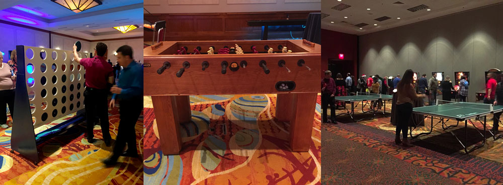
Conference
Thursday, October 24

7:30 - 8:30AM
Registration & Breakfast
8:30 - 9:00AM
Welcome & Introductions
9:00 - 10:00AM

Keynote Presentation
Leslie Sweet, Senior Director of Public Affairs for H-E-B

Note: Our original keynote, Justen Noakes, was unable to attend and Leslie Sweet, Director of Public Affairs for H-E-B, presented in his place

Justen Noakes Headshot Leslie Sweet is H-E-B's Senior Director of Public Affairs, who gave an overview of H-E-B's robust and dedicated Disaster Response work.

View Slides

ALL DAY
10:00AM - 4:00PM

ESRI HOLL (FREE Hands-On Learning Labs)

Throughout the day on Thursday, ESRI will host self-guided courses in the Balcones Room covering ESRI software and key GIS techniques.

Stay tuned for course offerings.

10:00 - 10:30AM
Break & Exhibits
10:30AM - 12:00PM

Session A (Big Tex)
Emergency Management

10:30 – 11:00AM
Hurricane Emergency Response - Operational and Technical Infrastructure Challenges

JD Godchaux, Customer Success Manager with CARTO | Jeff Goalen, Director of Budget Support Services at Harris County, Texas, Dominic Lai, Budget Support Services at Harris County, Texas

Description & Bio

View Slides

11:00– 11:30AM
Materials Management for Debris Planning and Emergency Response – The Disaster Debris Recovery Tool (DDRT)

Rachel Snavely & Erik Christianson, U.S. Environmental Protection Agency - Region 6

Description & Bios

View Slides

11:30AM – 12:00PM
GIS and Water Rescue

Ronald Vaughn, Dallas Fire Department

Description & Bio

View Slides

Session B (Li'l TEX)
Transportation Analysis

10:30 – 11:00AM
Let’s Shake On It – Providing Roadway Match Points across Multiple Jurisdictions

Ken Haenel & Sean Moran, Austin Community College Incubator for Professional Skills

Description & Bios

View Slides

11:00– 11:30AM
NoSQL? No Problem. Using a Graph-based Database Can Improve Data Modeling and Analysis

Morgen Healy, Applied Geographics, Inc. | James Graham & Osheen Safarian, District of Columbia Department of Transportation

Description & Bios

11:30AM – 12:00PM
Tribal GIS for Transportation Planning

Ryan Fennell, Atkins

Description & Bio

View Slides

12:00 - 1:00PM
Lunch & Exhibits
1:00– 1:45PM

Platinum Sponsor Presentation
What's Driving Your Data? AppGeo Logo

Presented by Kate Hickey and Morgen Healy

Organizations are spending more time and money than ever on data, data science, and analytics. There is no question that data platforms are increasingly powerful and are a key ingredient to success. But organizations are making far more progress on the technological front of data use than the human one. Organizations want to leverage their data to make better decisions and improve outcomes, but in order to achieve this they also need to consider organizational realities, which is where the complexities lie. In this talk we will discuss various approaches and strategies for leveraging data (geospatial or otherwise) within your organization.

1:45 - 2:00PM
Break & Exhibits
2:00 - 3:30PM

Session A (Big Tex)
City Smarts GIS

2:00 – 2:30PM
Improving Community Services by Helping Citizens Find Their Lost Pets Through Interactive Web Map

Ari Kassin-Fuentes - Javier Jaime - Alan Lara, City of El Paso

Description & Bio

View Slides

2:30 - 3:00PM
Leveraging GIS to Communicate Water Outages

Holly Pryor - Joe Sepulveda, City of Georgetown, Texas

Description & Bios

View Slides

3:00 – 3:30PM
Creating Open Data: Deliverables for Humans

Jordan Carmona, GISP, City of McKinney

Description & Bio

View Slides

Session B (Li'l TEX)
3D GIS

2:00 – 2:30PM
Coming to a Theater Near You, Your GIS in 3D!

Timothy Bohn, SURDEX Corp

Description & Bio

View Slides

2:30 - 3:00PM
Application of Drone Photogrammetry and LiDAR in Volumetric Change Analysis of Permanent School Fund Surface Mines

Daniel Gao - Bill Farr - Scot Friedman, Texas General Land Office

Description & Bios

View Slides

3:00 – 3:30PM
Improving 3D Buildings into Realistic Objects

Miguel Pavon, Texas Natural Resources Information System

Description & Bio

View Slides

3:30 - 4:00PM

Break & Exhibits

4:00 - 5:00PM

Session A (Big Tex)
Census 2020

4:00 – 4:30PM
2020 Census Geographic Programs Debrief

Jim Castagneri - Lacey Loftin, U.S. Census Bureau

Description & Bio

View Slides

4:30 - 5:00PM
Demonstration of Data.census.gov

Lacey Loftin, U.S. Census Bureau

Description & Bio

Session B (Li'l TEX)
Workflow GIS

4:00 – 4:30PM
Improving Property Data Management at the San Antonio River Authority

Philip Brown - Elizabeth Garcia, San Antonio River Authority | Caitlin Schneider, Applied Geographics, Inc.

Description & Bio

View Slides

4:30 - 5:00PM
Analyzing Food Inspection Scores in Austin, TX using Spatial Statistics

Nathaniel Dede-Bamfo, Texas State University

Description & Bio

View Slides

5:00PM

Closing Remarks - Richard Wade, TNRIS Deputy Executive Administrator/GIO

Conference
Friday, October 25

8:00 - 9:00AM
Registration & Breakfast
9:00 - 10:00AM

Town Hall: State of the State

Federal Activity Updates with State Impact

View Slides

10:00 - 10:15AM
Break
10:15 - 11:30AM

Town Hall: State of the State Cont'd

State Initiatives and Data Priorities

Land Parcels, Address Points, Lidar Roadmap, Statewide Imagery

View Slides

Scanning for TNRIS's Historical Imagery Archive

View Slides

11:30AM - 12:00PM

Open Discussion & Closing Remarks


Platinum Sponsors

Surdex geospatial logo and link appgeo logo and link to website Esri logo and link to website

Silver Sponsors

Fugro logo and link Merrick logo and link GeoComm logo and link Blue Marble logo and link SCAUG logo and link Sanborn logo and link to website Geocortex logo and link Tyler Tech logo and link Aecom geospatial logo and link
KCI Technologies logo and link Miller Imaging logo and link Intrado, Inc logo and link Geoshack logo and link

Exhibitors

  • USGS Water Science Center
  • Tessellations Incorporated
  • Austin Community College, GIS and Geospatial Engineering Departments
  • TeachMeGIS
  • The Conrad Blucher Institute for Surveying and Science (CBI) at Texas A&M University – Corpus Christi
  • Razor-Tek
  • Texas Department of Transportation (TxDOT)